
Autonomous Precision: The Future of Sustainable Weed Management.
AI-Driven, Drone-Delivered, Edge-Powered: A CQUniversity Research Initiative Bridging the Lab and the Field
Funded by the Australian Economic Accelerator (AEA) 2025 Round 1 and proudly supported by Camzilla, Impexpo Group Pty Ltd, DQ Commodities PTY LTD, ConnectAuz Pty Ltd., Logical Analysis Pty ltd., Department of Agriculture and Fisheries- Northern Territory






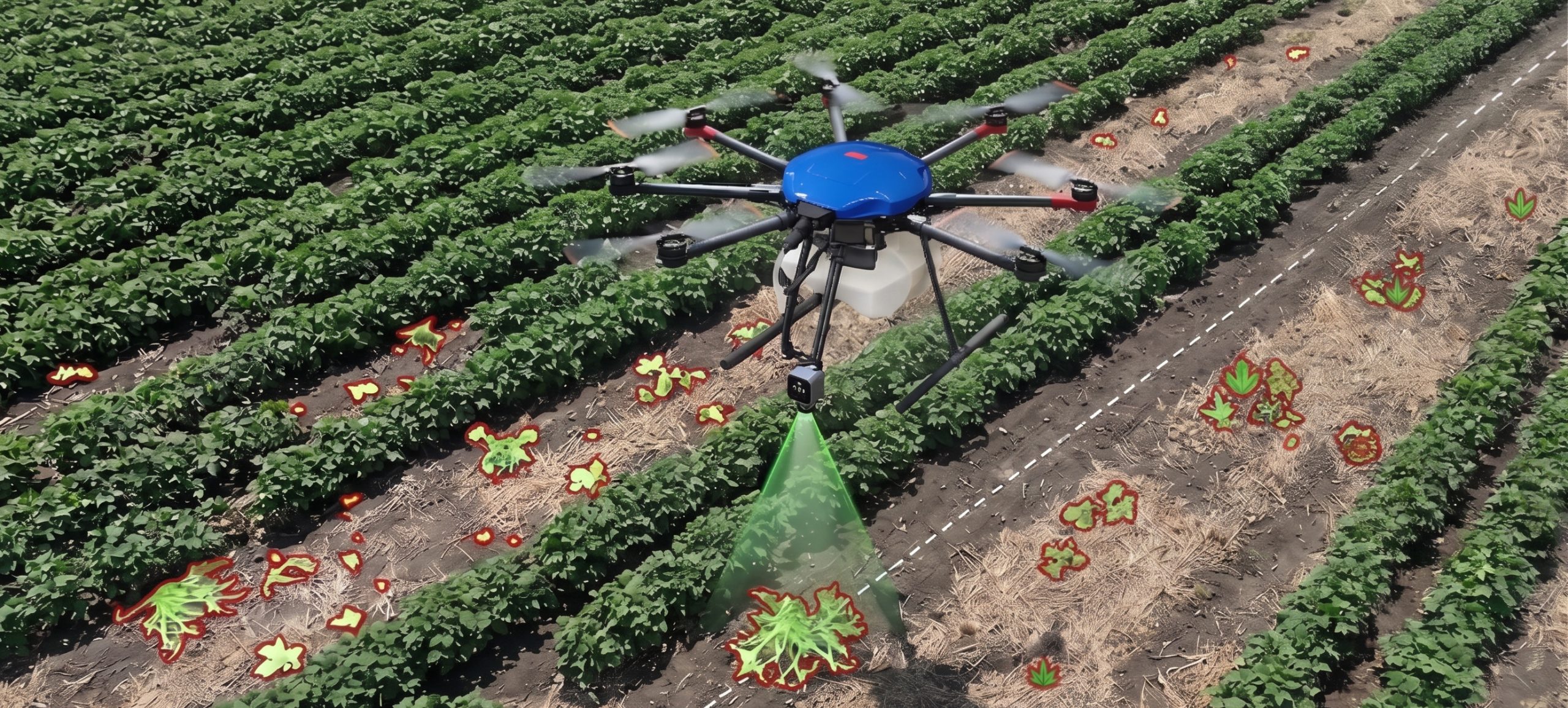
From Blanket Spraying to Intelligent Precision
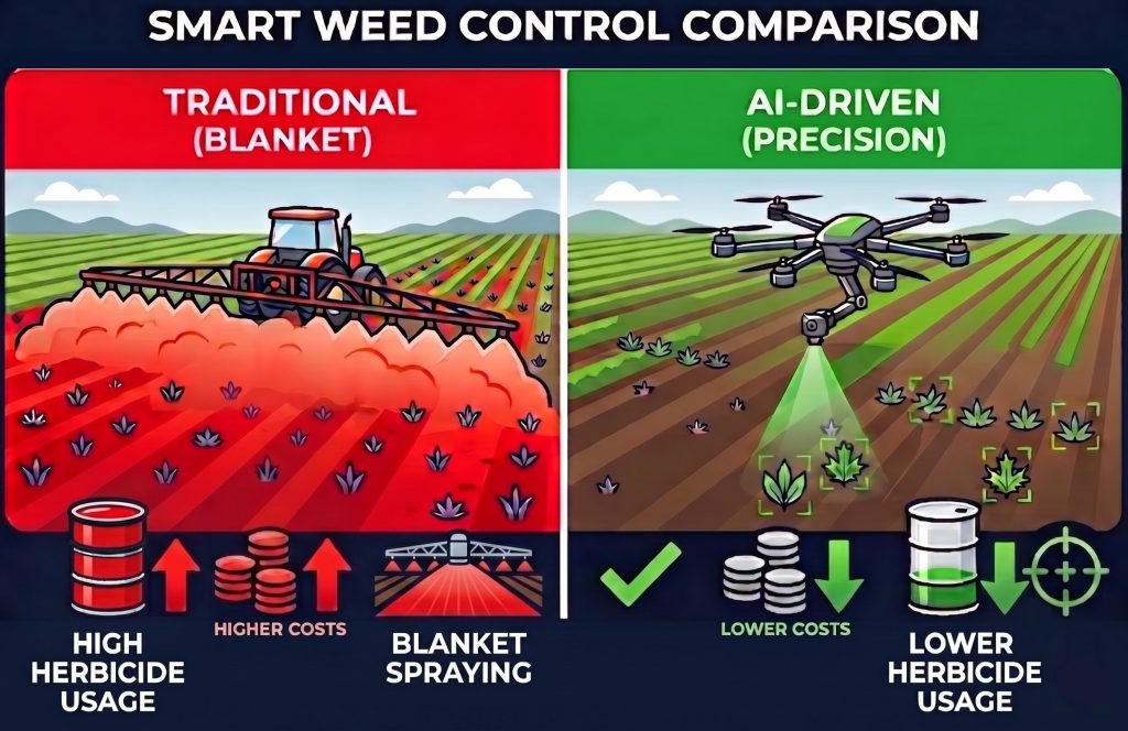
Australian farmers face a $5 billion annual battle against weeds. Traditional blanket spraying applies herbicides across entire fields, leading to unnecessary chemical use, increased costs, and environmental impact. AI-powered smart spraying targets only detected weeds, delivering a smarter, more sustainable approach to crop management.
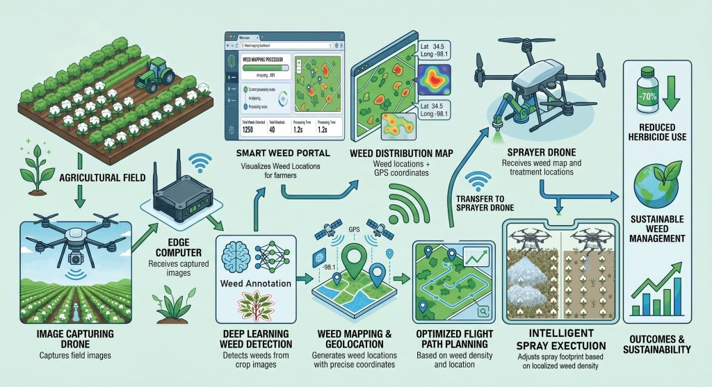
System Architecture: The Smart Pipeline
SmartWeedControl
Details
Aerial Field Surveying
Effective weed management begins with complete, reliable field coverage. Our dedicated imaging drone systematically surveys the entire cotton field, capturing high-resolution aerial imagery that is transferred for processing, with no data gaps and no missed treatment zones.
On-Site Edge Processing
Captured field imagery is transferred through DJI’s cloud infrastructure and delivered to an on-site edge computing device, where all weed detection, map generation and treatment planning are processed locally. This architecture keeps decision-making fast and operationally independent — the sprayer drone receives its instructions directly from the edge device without additional cloud dependency at the treatment stage.
Green-on-Green Processing
One of the most significant challenges in ag-tech is differentiating green weeds from green crops. Our Edge computing system processes complex visual data to accurately segment weed clusters from the surrounding cotton plants, generating highly precise geo-located maps.
AI-Powered Smart Weed Detection
Detecting every weed across an entire field scan regardless of size or location, demands more than conventional image analysis. Our deep learning model systematically analyses each captured frame, automatically flagging all weed presence to build a complete spatial record of weed distribution across the field.
Precision Weed Mapping
Raw detection data is only useful when it can be acted on. Our system converts identified weed locations into georeferenced treatment maps, giving operators a precise spatial picture of weed pressure across the field.
Adaptive Spot & Blanket Spraying
Applying uniform treatment intensity across an entire field wastes chemicals and drives up cost. Our system reads weed size and density to make intelligent spray decisions, pinpoint spot treatment for isolated weeds, broad blanket coverage for denser infestations.
Optimised Treatment Flight Paths
Inefficient spray routes mean longer operations, higher energy use and unnecessary cost. Our system automatically translates treatment maps into optimised trajectories, maximising field coverage while minimising flight time and operational overhead.
Precision Herbicide Delivery
Conventional spraying applies herbicide indiscriminately, including the gaps between weeds. Our automated spray control releases herbicide only over confirmed weed locations, eliminating waste and reducing the overall chemical footprint of every operation.
Intelligent Spraying Arm
Fixed-nozzle systems struggle to deliver accurate treatment to individual isolated weeds. Our onboard articulated spraying arm repositions the nozzle directly over each target, achieving precision where standard configurations fall short.
Dual-Drone Autonomous Workflow
Coordinating detection, mapping, planning and spraying as separate manual steps introduces delays and human error. Our imaging drone and herbicide sprayer operate as a fully coordinated autonomous system, executing the complete pipeline from initial field scan to final spray delivery without manual intervention.
Scalable Multi-Asset Coordination
Single-drone operations become a bottleneck across large farming environments. Our connected framework supports simultaneous deployment of multiple imaging and sprayer drones, enabling efficient, scalable coverage across extensive agricultural areas.